Lotz Road Reconstruction, Watermain, and H/H
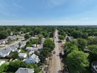
Spalding DeDecker (SD) was selected by the Charter Township of Canton to provide survey and design services for the reconstruction of Lotz Road from Cherry Hill Road to M-153 (Ford Road). Wayne County received funding from the Roads and Risks Reserve (RRR) Fund in December of 2013, and the Charter Township of Canton was chosen to procure the design services for the project. As a result of this funding, the project has a goal of being completed by the end of the 2015 construction season.
LOTZ ROAD RECONSTRUCTION
The project scope included reconstructing the existing gravel road to provide a three-lane concrete class A roadway that matched the sections north and south of the project. The radii of the horizontal curves at the south end of the project were improved, and a 4% superelevation rate was used to maximize the design speed of the roadway while minimizing ROW impacts. Three parcels, two of which were owned by the Township, required permanent ROW acquisition for the improved geometrics. Lotzford Rd approach and 29 other parcels required temporary construction permits for grading and driveway and sidewalk reconstruction. Culvert replacements were designed at Willow Creek and the Clark Drain, and an enclosed storm water drainage system was necessary due to the widened roadway section. The existing traffic signals at Cherry Hill Road were upgraded to mast arms, and a left-turn phase was added. The left-turn lane on EB Cherry Hill Road to NB Lotz Road was extended, and a right-turn lane was added on SB Lotz Road. ADA ramp upgrades, permanent pavement markings, and permanent signing work were performed throughout the project limits.
WATERMAIN
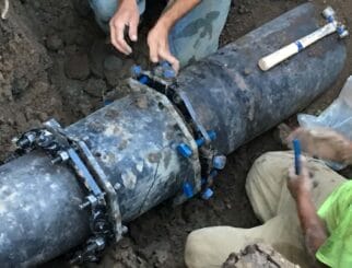
The watermain was designed in conjunction with the reconstruction of Lotz Road. This design will allow the Township to loop a portion of the water system as well as provide community water to an area of the Township that is seeing increased development.
While preparing plans to pave Lotz Road between Cherry Hill and Ford Roads, the Township decided to incorporate a 12” watermain to complete a loop of the system on the east side of the Township and also provide potable water to the area for future development.
The majority of the watermain will be placed within the existing 33-foot road right-of-way along the east side, with a portion being placed to fall within the proposed 43-foot right-of-way. An easement is being secured for that portion of the watermain. The route crosses two drainage features that require using directional drilling techniques to avoid open cutting streams. Various water line stubs have been designed to cross Lotz Road for future development.
HYDROLOGIC AND HYDRAULIC ANALYSIS
The project area included culvert crossings over Willow Creek and Clark Drain. As part of the project, both culverts had to be removed and replaced. SD performed hydrologic and hydraulic modeling to compute the flows for the streams at the culvert locations and determine appropriate culvert type and dimensions.
Willow Creek had an existing Federal Emergency Management Agency (FEMA) flood study and established Base Flood Elevations (BFEs) in the vicinity of the study area. However, only the 100-yr and the 500-yr flows were published in the Flood Insurance Study (FIS). SD used a USGS software program called PeakFQ which used a Log-Pearson Type III statistical analysis technique to analyze peak flow data at stream gages and compute peak discharges for various flood frequencies. A stream with similar watershed characteristics and similar drainage area in the same hydrogeologic region was selected and used to estimate flows for Willow Creek. A hydraulic model using the HEC-RAS computer program was developed using field survey, LiDAR data, and existing culvert information. Various proposed condition models were developed by using different culvert geometries to find a culvert large enough to carry the 100-yr flow. Spalding DeDecker used the hydrologic and hydraulic analysis to prepare a Michigan Department of Environmental Quality (MDEQ) and US Corps of Engineers joint permit application and Letter of Map Revision (LOMR) documents for FEMA map updates.
Spalding DeDecker developed a rainfall-runoff model for Clark Drain using a combination of HEC-HMS, HEC-GeoHMS, and GIS software. The modeling approach utilized rainfall data for various recurrence intervals and computed corresponding runoff estimates using topographic, Landuse, and Soil data. SD developed a hydraulic model using the HEC-RAS computer program using flows from the rainfall-runoff model, field survey, and LiDAR topographic data. The model was used to determine an appropriate culvert size to completely contain the 100-yr flow. Using the hydrologic and hydraulic analysis, SD prepared MDEQ and FEMA pre-construction permit applications.


