USGS Gages
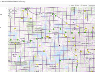
Spalding DeDecker developed a procedure to analyze peak flow data from multiple USGS stream gages at once using a computer program developed by USGS called PeakFQ. The PeakFQ program uses stream gage data and generates statistical flows for the 2-, 5-, 10-, 25-, 50-, 100-, and 500-yr storm frequencies. SD collected latitude and longitude information for all the stream gages in the State of Michigan and developed a GIS map by showing each gage as an individual point on the map. SD has linked the PeakFQ results obtained from individual stream gages and added them to their spatial point file on the map. By doing so, SD had developed a comprehensive database of all the USGS stream gages in Michigan and attached the flows for various flood frequencies as their attributes. SD also created a Google-Earth application with all the gage data overlaid on the Google-Earth interface. This helped the engineers at SD to get an understanding of the flow patterns within the state and the ability to quickly obtain or estimate flows for any stream within the state.


